Mapping the Northern Sky
Long before satellite navigation and GPS, explorers were already setting their sights toward space. Since we first saw the night sky, humanity has been fascinated by the stars. Over thousands of years, astronomers have …
以下正文同步自 Hacker News,版权归原站所有,已转换为易读排版。
Submitted Map
September 22, 2025
Natural Wonders
Long before satellite navigation and GPS, explorers were already setting their sights toward space. Since we first saw the night sky, humanity has been fascinated by the stars. Over thousands of years, astronomers have tracked the positions of stars and other objects (such as planets, which were described as planetes, or wanderers, by the ancient Greeks). They used the stars to tell stories, make predictions, and even find their way. All of which depended on having an accurate map, mental or otherwise, of the heavens above.
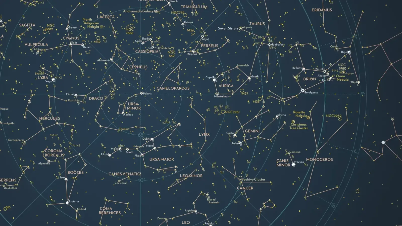
This stunning map by Florian Winkler catalogs the stars of the night sky in the Northern Hemisphere. It’s built using information from Stellarium, the HYG Database, and W. H. Finlay’s Concise Catalog of Deep-sky Objects.
The map shows the accurate position and brightness of stars, Messier objects (such as nebulae or spiral galaxies), and constellations. Winkler’s meticulous symbology differentiates stars by their brightness and variability. Labels identify stars and constellations, as well as their Bayer designation.
In the center of the map, you’ll find Polaris, or the North Star. The map’s stereographic projection reflects what you would see if you were to stand at the North Pole and look skyward. Polaris would be directly above you in the center of the sky. The rest of the stars are charted by their celestial coordinates, which function similarly to longitude and latitude. Known as declination and right ascension, the radial grid on the map shows these coordinate lines, reminiscent of meridians and parallels on a terrestrial map. A dashed circle cutting through the center of the map is the ecliptic, which shows the path of the Sun and planets through the sky.
While it’s easy to get lost in the details of the map, it never overwhelms. The map evokes the feeling of gazing at the infinite night sky. Yet it includes enough context to orient yourself and feel like a seasoned astronomer. Winkler’s work blends millennia of celestial knowledge with modern cartographic techniques to create a dazzling map that parallels the wonder of the stars themselves.
Submitted Map
This map was contributed through the Maps.com submission program. If you’d like your map to be featured, submit it for consideration.
正文由 探How 从来源站点 RSS 同步,内容未经改写;遇到排版缺失或需要图片、视频时请以原文为准。