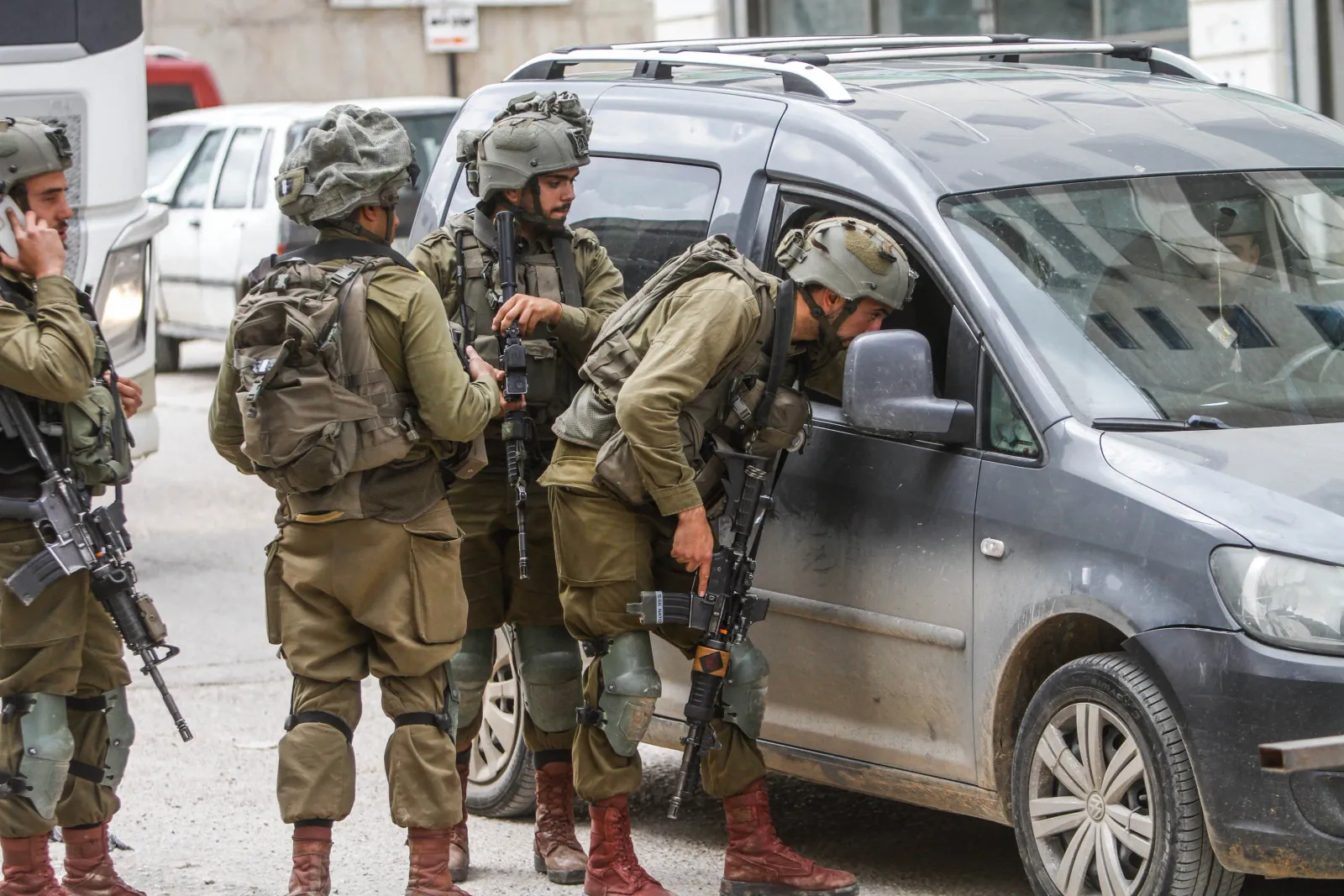
How Israeli Checkpoints Choke Palestinian Life in the Occupied West Bank
Lost time. Lost jobs. Lost friends. Lost family. Lost lives. Our joint investigation reveals the system that has divided the West Bank and measures what it cost people to move through it.
以下正文同步自 Wired,版权归原站所有,已转换为易读排版。
Lost time. Lost jobs. Lost friends. Lost family.
How Israeli checkpoints suffocate Palestinian life in the occupied West Bank.
Lost time. Lost jobs. Lost friends. Lost family. Lost lives. How Israeli checkpoints suffocate Palestinian life in the occupied West Bank.
Aref Jaber is on a neighbor's roof, trying to get home.
At 51, he is clambering over a wall into the next backyard, up onto the next roof, along the line of stone houses that stand between him and his own front door. He has no choice. Alleys and side streets in his neighborhood have been sealed with cement blocks and barbed wire, and a single point of access, called Checkpoint 160, is the only way in or out for the 140 families who live there.
But Checkpoint 160 is closed again; Jaber is not sure why. The whim of a soldier, a crash in the scanning system, breaking news in the region—it could be anything.
For the last three years, he says, this has happened at least two days a week. So the community has devised a system of alternative routes. Jaber calls his neighbors to ask if he can come through. They check their windows for soldiers, and then Jaber scales ladders and traverses roofs. “When I finally get home,” he says, “it feels like I’ve achieved something monumental.”
The enclosure of Jaber’s neighborhood is a dense microcosm of what life is becoming across the occupied West Bank—for Palestinians, that is. At the same time that deadly Israeli settler violence robs communities in the West Bank of their land, and amid the genocide in Gaza, Israel has expanded its infrastructures of military control and domination.
Since 2023, Israel’s fragmentation of Palestine, underway for generations, has accelerated. The West Bank has, for the nearly 3.5 million Palestinians who live there, ceased to exist as a contiguous territory. According to the most recent UN data from December 2025, at least 925 fixed and temporary checkpoints, metal gates, roadblocks, and earth mounds divide the West Bank. (A Palestinian governmental commission reported this month that the number is now 942.) This fracturing has torn families apart, stifled the economy, and obstructed access to essential services such as hospitals and schools.
Aref Jaber climbs onto the roof of a neighbor's home to get to the street in the Jaber neighborhood in Hebron. PHOTOGRAPH: SAMAR HAZBOUN
Israel has never publicly listed the checkpoints it operates, their staffing hours, or their closure times. On the ground, Google Maps is practically useless for Palestinians; it is blind to the checkpoints and tries to route drivers onto roads reserved for Israeli-plated cars. Instead, citizens have developed their own ad hoc networks to inform each other of closures.
As far as we know, no organization has used that network—combined with new datasets and on-the-ground reporting—to measure what this does to daily life.
Over 18 months, WIRED, Lighthouse Reports, Arab Reporters for Investigative Journalism (ARIJ) and the Palestine Reporting Lab investigated the system that has carved the West Bank into cantons and measured what it cost people to move through it.
We analyzed tens of thousands of Telegram messages Palestinians sent to navigate daily checkpoint delays and closures
📍حوارة مغلق البديل عورتا و لكنها أزمة 📍 Huwwara is closed, the alternative is Awarta, but it's congested
📍عورتا أزمة خانقة الآن. حاجز المربعة سالك 📍 Awarta is severely congested now. Al-Muraba’ah checkpoint is open
📍حاجز المربعة أزمة 📍 Al-Muraba’ah checkpoint is congested now
Working with the Institute for Social and Economic Progress (ISEP), a Palestinian research organization, we polled hundreds of people across the West Bank to find out how checkpoints shape their lives.
Israel has never publicly listed the checkpoints it operates, their staffing hours, or their closure times. On the ground, Google Maps is practically useless for Palestinians; it is blind to the checkpoints and tries to route drivers onto roads reserved for Israeli-plated cars. Instead, citizens have developed their own ad hoc networks to inform each other of closures.
As far as we know, no organization has used that network—combined with new datasets and on-the-ground reporting—to measure what this does to daily life.
Over 18 months, WIRED, Lighthouse Reports, Arab Reporters for Investigative Journalism (ARIJ) and the Palestine Reporting Lab investigated the system that has carved the West Bank into cantons and measured what it cost people to move through it.
We analyzed tens of thousands of Telegram messages Palestinians sent to navigate daily checkpoint delays and closures.
📍حوارة مغلق البديل عورتا و لكنها أزمة 📍 Huwwara is closed, the alternative is Awarta, but it's congested
📍عورتا أزمة خانقة الآن. حاجز المربعة سالك 📍 Awarta is severely congested now. Al-Muraba’ah checkpoint is open
📍حاجز المربعة أزمة 📍 Al-Muraba’ah checkpoint is congested now
Working with the Institute for Social and Economic Progress (ISEP), a Palestinian research organization, we polled hundreds of people across the West Bank to find out how checkpoints shape their lives.
Then, we manually verified over 800 movement obstacles using satellite imagery and on-the-ground reporting, and we mapped 2.6 billion GPS pings of drivers navigating the roads and closures. Explore and download the full map of verified checkpoints here.
We mapped 2.6 billion GPS pings of drivers navigating the roads and closures.
Then, we manually verified over 800 movement obstacles using satellite imagery and on-the-ground reporting. Explore and download the full map of verified checkpoints here.
The number of movement obstacles in the West Bank rose by more in the past three years than it did over the previous 18.
The average West Bank commuter—someone who drives several times a week—loses about an hour and a half each week to additional travel time in an effort to avoid checkpoints. Over the course of a year, that amounts to 77 hours lost.
For some, the delays are far longer. People going from Ramallah to Al-Eizariya, on the edges of Jerusalem, could do so in 27 kilometers/48 minutes. Instead, it's 45 kilometers/100 minutes.
Our data shows that people have to take all sorts of complex routes to avoid checkpoints.
Using the median route taken in our dataset, someone who commutes back and forth four days a week would lose nearly seven hours in additional travel time every week.
Anyone who commutes four days a week from Ramallah to Hebron is robbed of over 12 extra hours of travel time.
One pair of towns, Anabta and Beit Lid, are 8 kilometers apart.
It used to be a 10 minute drive. It now routinely takes 50 minutes each way.
CHECKPOINT: 'AWARTA COMMERCIAL'
SATELLITE IMAGE ©2026 VANTOR
RAMALLAH
BETHLEHEM
QALQILYA
NABLUS
JENIN
JERICHO
JERUSALEM
HEBRON
ISRAEL
GAZA STRIP
JORDAN
RAMALLAH
AL-EIZARIYA
HEBRON
ANABTA
BEIT LID
Our data analysis found that checkpoint delays have increased by more than 50 percent in the aftermath of October 2023, frequently exceeding hours at a time.
Together, Palestinians in the West Bank lose about 30 years every day.
Data can count the checkpoints, clock the closures, and tally the hours lost at the gates. But how does the system upend the life of a single family?
More than a decade ago, Amal and her family left the US. They moved back to a home in Al-Janiya, where they built a house with a garden, and a mountain view. “Mashallah,” she says of it still. (The names have been changed due to safety concerns.)
By the time the family arrived, Al-Janiya's main entrance had already been closed for over a decade. Israel sealed the eastern road in 2003; it now serves as an entrance to Talmon, an Israeli settlement built on the village's land.
The only way in or out of Al-Janiya that Amal's family has ever used runs west, through the neighboring village of Ras Karkar. Fifteen minutes down that road is her husband's shop in Ramallah.
A little further on, a local university, where her daughter Lina studies software engineering.
With open roads, Lina's commute could be around 12 kilometers/20 minutes.
With the detour because of a checkpoint, it became 32 kilometers/47 minutes.
Amal’s eldest, Dana, went farthest, to another university to study dentistry. She is set to be the first doctor in the family.
Dana's commute should be around 35.5 kilometers/47 minutes. It is now often a 90-minute drive.
AL JANIYA
RAS KARKAR
RAMALLAH
BIRZEIT UNIVERSITY
AL QUDS UNIVERSITY
Every day that Dana and Lina drive to their universities, they each lose about an hour on the circuitous route and at checkpoints. Over the course of an academic year, they have lost about three days each due to the detours.
“You loop and loop and end up at the same point… I swear, I get dizzy… By the time you arrive, you're just sad. You sit there asking yourself: what is this life?” Amal said. "You can take it once. Twice. For a year. Then it crosses some limit and you can’t.”
Thirty percent of people in the West Bank said that checkpoints have prevented them from starting or completing a university education. Most students living outside major cities cross at least one checkpoint on the shortest route to their nearest university.
Last summer, Amal's family decided they couldn’t spend another academic year in Al-Janiya, and they moved near Ramallah. “We grieve leaving our village,” Amal said, “but it’s not really a choice.”
They join more than one in ten people in the West Bank who say they’ve moved to other cities or regions because of checkpoints, along with 31 percent who say they’re considering moving for the same reason.
Roads that once tied Palestine together have been closed off again and again, first by militarized borders and barriers, then by permits, and finally by hundreds of checkpoints.
Khalil Tufakji, a Palestinian cartographer and expert on Israeli settlements, has watched Israel assemble this system for decades. The purpose of checkpoints is the fragmentation of space, he said—“every city closes in on itself”—and in this way, the homeland shrinks to a city.
The system that confines Palestinians was built in layers. Under British colonial rule, Palestinian communities were at times subjected to roadblocks, systemic and capricious searches, border barriers, and a system of permits that restricted who could move by vehicle across the territory.
In 1948, in what is known as the “Nakba” or “catastrophe,” Zionist forces expelled more than 750,000 Palestinians from their homes. Hundreds of villages were depopulated or destroyed, and people were driven into exile.
Those who remained were placed under Israeli military rule for the next 18 years, forbidden to work, trade, study, or seek medical care beyond their towns without an Israeli permit.
In 1967, when Israel seized the remaining Palestinian territories, it reconstructed the same permit system there. Palestinians were sorted into categories, the color of an ID card determining who may go where.
In 1988, UN Special Committee reports classified the closing of areas in the occupied territories as collective punishment.
In 1995, the Oslo Process resumed. It was meant to lead to the establishment of a sovereign Palestinian state. Instead, it further fragmented Palestinians by dividing the West Bank into administrative islands.
By the early 2000s, this system of closures and permits had become the status quo. In 2002, Israel started building the 713-kilometers-long separation wall, 85 percent of which runs through the West Bank.
And since 2007, Israel has imposed a blockade on Gaza, isolating it from the rest of Palestine.
In the years that followed, the restrictions intensified.
In 1948, in what is known as the “Nakba” or “catastrophe,” Zionist forces expelled more than 750,000 Palestinians from their homes. Hundreds of villages were depopulated or destroyed, and people were driven into ex
正文由 探How 从来源站点 RSS 同步,内容未经改写;遇到排版缺失或需要图片、视频时请以原文为准。